States Use Data Visualization Tools to Address Health Concerns
September 29, 2022 | Emma Talkington, Dan Tauriello, Emma Carlson
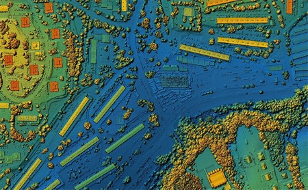 Geographic Information Systems (GIS) and other data visualization tools have become integral parts of public health decision-making workflows and provide crucial support to topic areas such as environmental health, the COVID-19 pandemic response, and chronic disease investigation and prevention. GIS can visualize almost any data with a location component. When thinking specifically about environmental health, this flexibility allows for more efficient locating and tailoring of responses to both short- and long-term environmental hazards.
Since the start of the COVID-19 pandemic, the utility of these tools has been even further recognized and leveraged by public health agencies around the nation. Geospatial services and data have also been “democratized” and brought into the public eye through websites and applications that are freely available and make use of data from new sources and partnerships. This newfound visibility of GIS underscores a need for improved geospatial infrastructure and staff expertise.
In 2021, ASTHO began convening a group of GIS professionals in state and territorial health agencies (S/THAs) to discuss innovative applications of GIS technology to their work. This GIS Innovations Community of Practice (GIS CoP) works to build a collective evidence base for GIS and geospatial technology use in public and environmental health practice. By discussing challenges, sharing promising practices, and gaining a greater understanding of these technologies, the GIS CoP supports S/THA GIS professionals as they leverage these tools for mapping, surveillance, health communication, and decision-making, with a specific focus on environmental health applications.
Health Agencies Utilize GIS to Improve Public Health
Many states utilize GIS tools to create interactive maps and platforms to raise awareness about specific public health issues and connect communities with resources and information.
The Montana Department of Public Health and Human Services (MT DPHHS) houses several interactive maps and story maps on their website, which provide information on relevant public health issues and available resources to help address those issues. Story maps are tools for effectively housing multiple maps and including context and rationale for the data used to build the maps. MT DPHHS’s Joy in Healthy Living story map provides “easy access to healthy lifestyle strategies for youth and adults.”
The Arizona Department of Health Services (ADHS) regularly uses GIS tools to gather information from providers about where the public can find COVID-19 testing and vaccination sites. Using these data, ADHS developed two maps to help the public find COVID-19 testing and vaccine sites.
GIS tools can also help S/THAs take targeted action to protect against environmental health threats. In 2019 and 2020, there were regional outbreaks of Eastern equine encephalitis (EEE), a rare mosquito-borne disease, in Indiana. During these outbreaks, the Indiana Department of Health (IDOH) utilized GIS tools to help guide response efforts. CDC reports that EEE infections are uncommon, with only a small number of cases reported yearly in the United States.
IDOH mapped EEE cases in humans, horses, and mosquitoes using GIS tools, which helped to identify the location of mosquitoes carrying the virus. In conversation with ASTHO, IDOH shared that it treated suspected high-risk areas with aerial application of pesticides, while avoiding “areas where pesticide application was undesirable, such as USDA-certified organic farms.” Following these targeted spraying efforts, Indiana has not identified new EEE infections.
The Connecticut Department of Public Health’s Childhood Lead Poisoning Prevention Program (CT CLPPP) uses GIS tools to assist with the identification, surveillance, and prevention of lead poisoning in children. The program also uses GIS tools to help prioritize the replacement of lead service lines, which, according to EPA, can be an important contributor to lead in drinking water.
In both instances, CT CLPPP uses the Social Vulnerability Index, a tool created by CDC and the Agency for Toxic Substances and Disease Registry, to target lead poisoning prevention efforts for those communities in most need. In the future, the program hopes to automate geocoding of lead poisoning cases to provide real-time situational awareness to agency management and supplement local health departments’ awareness of new cases and potential exposure sources (e.g., lead-based paint, drinking water).
Engaging Leadership and Staff to Promote the Use of GIS Tools
When developing and utilizing GIS tools, it is important to engage leadership who can help ensure continued implementation of these tools and promote them more widely. Other staff who may not be aware of the power and utility of GIS, both within and outside the health agency, are also important to engage. S/THA staff from ADHS, CT CLPPP, IDOH, and MT DPHHS shared best practices based on their own experiences of working with their leadership, as well as other colleagues in the health department, to develop GIS tools and advocate for their use to aid in public health decision-making.
 |
Arizona |
|
 |
Connecticut |
|
 |
Indiana |
|
 |
Montana |
|
Looking Forward
ASTHO will continue to convene the GIS CoP to help S/THAs build capacity to apply GIS tools to public health practice. Looking forward, ASTHO hopes to recruit additional interested S/THA staff to the GIS CoP and continue highlighting innovative applications of GIS to public health decision-making and interventions.
Special thanks to the Arizona Department of Health Services, the Connecticut Department of Public Health, the Indiana Department of Health, and the Montana Department of Public Health and Human Services for providing input used in this blog post. Additionally, a special thanks to Nicholas Porter and Zeeshawn Chughtai for their support in developing this post.